Names and dates
For Post-rock, a discographic coordinate in 1991 and a critical formulation in 1994 answer different questions. Neither is presented as a single absolute birth date.
Simon Reynolds, The Wire 123 (1994), pp. 28–32 Urban Subcultures Interactive Map
17.11.2026 · presentation-1
Purpose, research method and intended image use
A documented historical research project combining a chronological map, contextual accounts and a geographical atlas. Its purpose is to make cultural connections and the limits of their evidence open to examination.
Research-candidate snapshot, 17 November 2026. These counts describe an editorial model, not a census of cultural participation.
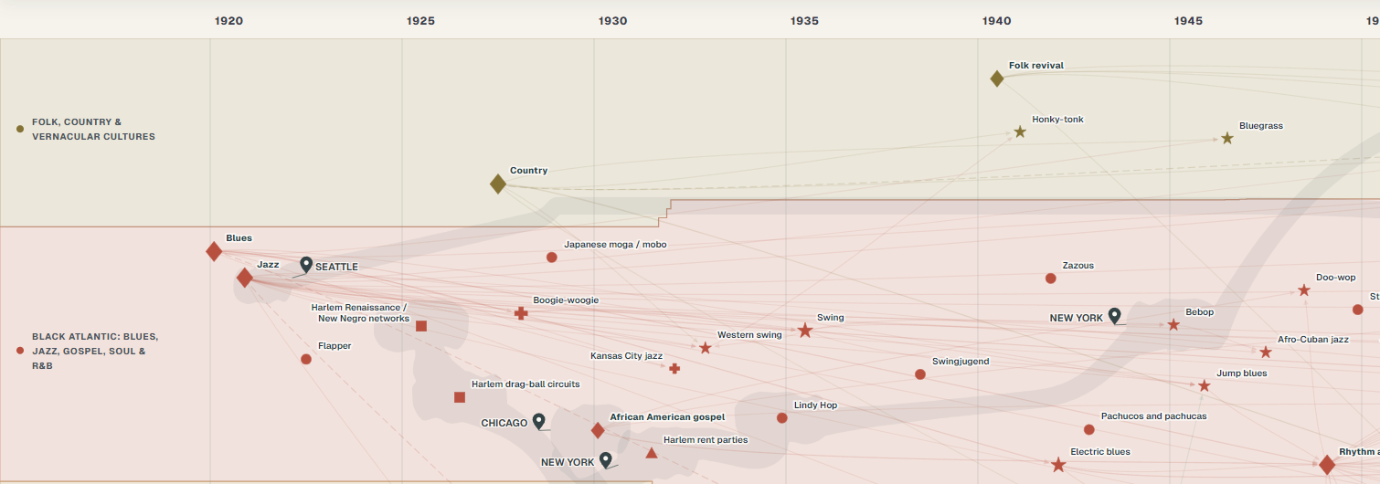
The current candidate contains 459 nodes, 682 genealogical relationships, 82 shared-listening relationships and 21 associations. Urban scenes comprise 19 scenes and 51 episodes. The geographical atlas records 67 referents, 151 places and 309 documented presences. It holds 480 infrastructure measures and 9 audience measures, with no verified count of adherents. These different units are not combined into a population total.
Readers interested in cultural history, music, research, teaching and public history. These are intended uses, not evidence of measured audience, institutional adoption or impact.
Search, time filters, typed relationships and linked source notes let readers compare interpretations and follow connections that a single static chart cannot show in the same form. The public introduction remains separate from the complete research map.
A preliminary, informational presentation of the project and its method, not a navigable map. The complete interactive map remains offline while image permissions are being assessed.
Dates, shapes and lines are argued editorial choices. Each record identifies sources and distinguishes direct consultation, selected passages, catalogues and materials not examined in full. The coverage is selective and open to correction.
For Post-rock, a discographic coordinate in 1991 and a critical formulation in 1994 answer different questions. Neither is presented as a single absolute birth date.
Simon Reynolds, The Wire 123 (1994), pp. 28–32For Boom bap, sampling, loops and the relation between beat and voice are described as situated practices. A sampled beat alone does not define a whole community or category.
Phillip Mlynar, In Search of Boom Bap (2013)Manchester is approached through distinct networks, including the venues and reggae/punk encounters documented in Moss Side Stories. A scene area creates no additional genealogy.
Manchester Digital Music Archive, Moss Side StoriesMauro Pini is responsible for the concept, editorial direction, scope and approval of content. OpenAI Work and ChatGPT assist source comparison, drafting and translation; OpenAI Codex assists implementation and technical checks. These tools are neither human authors nor documentary sources. Final editorial responsibility remains with Mauro Pini.
Internal reviews and automated checks are not independent scholarly peer review. No completed independent peer review or institutional endorsement is claimed. The map interfaces are available in Italian, English, French, German, Spanish and Portuguese; this presentation is provided in English and Italian.
Photographs and archival documents are intended to support historical discussion of practices, people, clothing and spaces. They are not treated as freely reusable because they appear in a book, catalogue or online collection.
Caption, date, source and required credit
Historical interpretation and limits of the evidence
Link to the holding institution's catalogue record
The work-specific schedule will accompany each permission request. No permission is inferred from silence, collection ownership or a rights holder's receipt of this dossier. Browser display cannot guarantee that an image cannot be saved.
For permissions, attribution or historical corrections, contact the author. Identify the work or record and, where possible, provide a catalogue link, date or page reference. Do not send unnecessary personal information.
pini.mauro@outlook.comMauro Pini
Author and editorial director · Independent historical research · Italy
Project websitewww.urbansubculturesmap.com
Informational presentation only. The complete interactive research map is offline.